The Role of Technology in Modern Emergency Response: Tools Empowering Teams and Communities
How Technology Has Changed the Emergency Response Landscape
Modern emergency response looks fundamentally different than it did two decades ago. Where responders once relied on paper maps, radio chains, and word-of-mouth coordination, today's teams operate with digital tools that compress decision timelines from hours to minutes.
That shift matters because emergencies don't wait. A wildfire that jumps a containment line, a flood that isolates a neighborhood, a mass casualty event in a crowded venue — each scenario demands speed, clarity, and coordination that traditional methods simply couldn't deliver at scale. Technology hasn't replaced the judgment of trained responders, but it has dramatically expanded what those responders can see, know, and do in real time.
For volunteer organizations and community service teams especially, this evolution is opening doors that were previously reserved for well-funded government agencies. Affordable platforms, cloud-based tools, and open-source systems now put serious capability within reach of almost any response team.
Real-Time Communication and Coordination Tools
Real-time communication platforms reduce the delays and confusion that cost lives during active incidents. When multiple agencies respond to the same event — fire, law enforcement, EMS, public works — the ability to share information instantly across those teams is the difference between coordinated action and dangerous overlap.
Platforms built around incident command systems (ICS) now integrate digital communication layers that let commanders push updates to every unit simultaneously. Tools like FirstNet (a dedicated broadband network for first responders in the U.S.) and interoperable radio systems ensure that a firefighter and a paramedic on the same scene are working from the same operational picture, not two different versions of it.
For community response teams and volunteers, mobile apps have become practical coordination hubs. Group messaging platforms with role-based access, shared task lists, and check-in features let volunteer coordinators track who's deployed, where, and doing what — without a dedicated dispatcher. That kind of lightweight infrastructure has real value when a team of 30 volunteers is managing flood sandbag distribution across four neighborhoods at once.
GIS Mapping and Situational Awareness in the Field
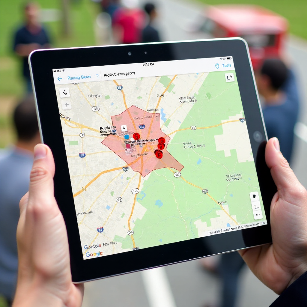
GIS mapping gives responders and incident commanders a live operational picture that static maps can't provide. Geospatial data layers — showing road closures, utility infrastructure, population density, or real-time weather — can be overlaid and updated as conditions change.
Situational awareness is the core benefit here. A search and rescue team working a missing person case in a rural area can use GIS to divide search zones, track team positions via GPS, and avoid duplicating effort. An emergency manager coordinating shelter logistics can see in real time which facilities are at capacity and which have space. Decisions that once required a phone tree and a printed map now happen in seconds on a shared digital interface.
Open-source platforms like QGIS and ArcGIS Online have made geospatial tools accessible beyond large municipal agencies. Many volunteer fire departments and community emergency response teams (CERTs) now use GIS-based tools during exercises and real deployments. The learning curve is real, but the payoff in operational clarity is significant.
Drones and Remote Technology on the Front Lines
Drones — more formally, unmanned aerial vehicles (UAVs) — have become one of the most versatile tools in the modern emergency response toolkit. They extend a team's eyes into areas that are too dangerous, too remote, or too structurally compromised for human entry.
In search and rescue, a UAV equipped with thermal imaging can cover terrain in minutes that would take a ground team hours to search. After a building collapse or wildfire, drones provide damage assessment data that informs resource deployment before a single responder sets foot in a hazardous zone. During active flooding, they can deliver small supplies or communications equipment to isolated individuals.
The practical barrier for many volunteer organizations is cost and certification. In the U.S., commercial drone operation requires FAA Part 107 certification, and capable thermal-equipped UAVs run from several thousand dollars upward. Some regional emergency management agencies now maintain drone units that local volunteer teams can request as a shared resource — a model worth advocating for if your organization doesn't have direct access.
Technology Supporting Volunteers and Community Response Teams
Volunteer management software is one of the most underappreciated categories of emergency response technology. It addresses a specific and persistent challenge: keeping non-professional responders organized, trained, and ready to deploy when it counts.
Platforms designed for volunteer coordination handle scheduling, credential tracking, availability management, and communication in one place. When a large-scale disaster activates dozens or hundreds of volunteers, coordinators need to know instantly who is certified in first aid, who has a valid driver's license for transport roles, and who is geographically available. Doing that manually during an active incident is a recipe for chaos.
Training platforms have also evolved. Online learning management systems (LMS) let volunteers complete FEMA ICS courses, CPR certifications, and scenario-based training on their own schedule — removing the barrier of requiring everyone to show up at the same time and place. Some platforms include simulation exercises that build decision-making skills before volunteers ever face a real incident.
For teams exploring options, FEMA's Community Emergency Response Team (CERT) program provides training resources and guidance that many volunteer organizations use as a foundation alongside digital tools.
Mass Notification and Community Alert Systems
Mass notification systems bridge the gap between response teams and the public, enabling faster warnings and clearer instructions during emergencies. When seconds matter — a gas leak, an active threat, a flash flood warning — the ability to reach thousands of people simultaneously through multiple channels is critical.
Modern alert systems push notifications via text message, email, automated phone calls, social media, and digital signage simultaneously. The Wireless Emergency Alert (WEA) system in the U.S. can reach virtually every active mobile device in a geographic area without requiring prior registration. Local systems like Everbridge or Rave Mobile Safety allow emergency managers to segment alerts by neighborhood, zip code, or custom zone.
For community service organizations, these systems also support two-way communication. Some platforms allow recipients to confirm receipt, report their status, or request assistance — turning a one-way broadcast into an active data stream that helps coordinators identify where need is concentrated.
The public trust dimension matters here too. Clear, timely, and accurate alerts build community resilience over time. When people trust that official notifications are reliable and actionable, they're more likely to respond appropriately — reducing the burden on responders dealing with preventable situations.
Challenges and Considerations When Adopting New Technology
Technology adoption in emergency response comes with real barriers that deserve honest acknowledgment. Ignoring them leads to failed implementations and wasted resources.
Cost is the most obvious constraint. Enterprise-grade platforms built for large municipal agencies carry price tags that smaller volunteer organizations simply can't absorb. The answer isn't to avoid technology — it's to prioritize tools that offer tiered pricing, nonprofit discounts, or free tiers sufficient for small teams. Grant funding through FEMA's Hazard Mitigation Grant Program and similar sources can also offset technology costs for qualifying organizations.
Interoperability gaps remain a persistent frustration. When a county emergency management agency uses one platform and a neighboring jurisdiction uses another, information sharing breaks down precisely when it's most needed. The broader emergency management community has been working on interoperability standards for years, but the gap between policy and field reality is still significant for many regions.
Training requirements are often underestimated. A drone program without trained pilots is a liability. A GIS tool that no one on the team knows how to use during a high-stress incident is worthless. Technology adoption requires a parallel investment in training — and for volunteer organizations with limited time, that investment needs to be realistic and sustainable.
Digital equity is a consideration that emergency managers are increasingly taking seriously. Not every community member has a smartphone, reliable internet access, or the digital literacy to respond to tech-based alerts. Effective emergency communication still requires analog backups — sirens, printed materials, door-to-door outreach — to reach everyone, not just the digitally connected.
Frequently Asked Questions
What technology do emergency responders use most commonly today?
The most widely used tools include interoperable radio systems, GIS mapping platforms, mass notification systems, and incident command software. Mobile apps for field communication and volunteer coordination have also become standard in many departments and community response teams.
How can volunteer organizations access emergency response technology on a limited budget?
Many platforms offer nonprofit pricing, free tiers, or open-source alternatives. FEMA grant programs and state emergency management agencies sometimes fund technology for qualifying volunteer organizations. Shared regional resources — like a county drone unit or a centralized notification system — can also give smaller teams access to capabilities they couldn't afford independently.
What is interoperability and why does it matter in emergency response?
Interoperability refers to the ability of different systems, agencies, and technologies to communicate and share data seamlessly. It matters because emergencies rarely respect jurisdictional boundaries. When a wildfire crosses county lines or a multi-agency rescue operation unfolds, teams using incompatible systems lose critical time translating information between platforms.
How do drones improve search and rescue operations?
UAVs equipped with thermal imaging or high-resolution cameras can survey large areas quickly, locate heat signatures from missing persons in low-visibility conditions, and assess terrain or structural hazards before ground teams enter. They reduce risk to responders and dramatically accelerate the initial search phase.
How does technology help coordinate volunteers during a large-scale disaster?
Volunteer management software tracks availability, credentials, and deployment status in real time. Combined with mobile communication platforms and shared task management tools, these systems let coordinators assign roles, monitor progress, and adjust deployment as conditions change — without the confusion of manual tracking during a high-pressure event.